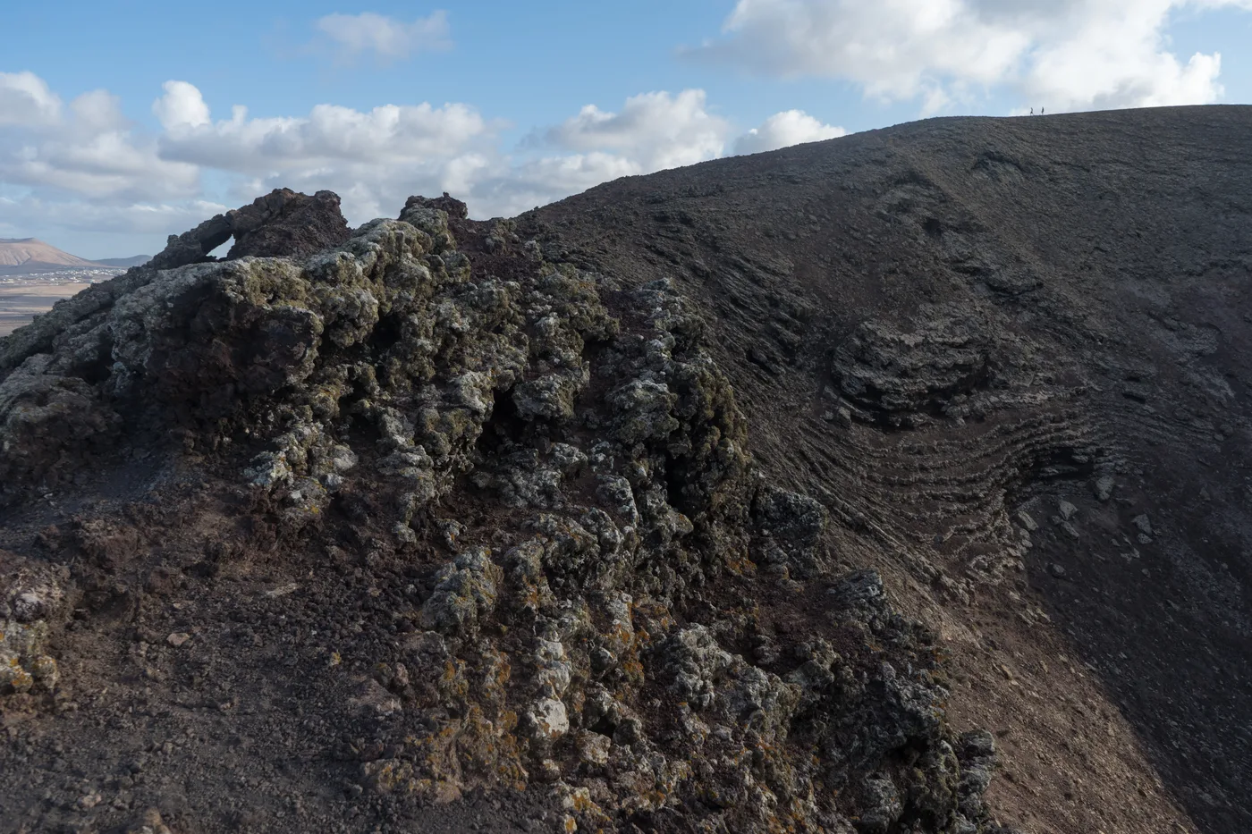
The volcanic crater rim of Calderón Hondo, its dark rock ridges leading up to the summit with a village visible on the plain below

Photo: Alexey Komarov (CC BY-SA 4.0), via Wikimedia Commons

Lajares, Fuerteventura

Calderón Hondo

An easy crater walk on one of Fuerteventura's best-preserved volcanoes

Calderón Hondo is a 273-metre volcanic cone on the edge of Lajares, in the north of Fuerteventura. It last erupted an estimated 50,000 years ago and is one of the best-preserved craters on the island — a walking path climbs to the rim and continues almost the full way round, giving views over the volcanic plain to Corralejo, Isla de Lobos and, on a clear day, Lanzarote. It's a short, moderate walk with no technical difficulty, one of the easiest volcano hikes on Fuerteventura.

The hike: route, distance and difficulty

The standard route starts at the signposted car park just outside Lajares and climbs gently onto the volcano's outer flank before joining the crater rim path. It's around 5 km there and back including a loop around part of the rim, with roughly 100 metres of total ascent — most walkers cover it in 45 minutes to an hour, faster if you skip the full loop.

The path is well marked and doesn't require any scrambling, but the surface is loose volcanic gravel and rock in places, especially near the rim, so proper closed shoes matter more than the modest distance suggests — this isn't a hike for flip-flops. There's no shade anywhere on the route, and the crater rim is often windy even when the village below is calm, so bring water, sun protection and a layer for the top even on a warm day.

The reward is the crater itself: a broad, roughly circular bowl around 70 metres deep, with sulphur-tinted rock visible on parts of the inner wall — a genuinely impressive sight for such a short walk, and one of the more dramatic close-up views of a volcano anywhere on the island.

What you're looking at, and nearby volcanoes

Calderón Hondo is extinct, not dormant — its last eruption is estimated at around 50,000 years ago, during the same volcanic period that shaped much of northern Fuerteventura. The crater's condition is unusually intact for its age, which is why it's become the island's best-known short volcano hike rather than one of the rougher, more eroded cones further inland.

It isn't the only volcanic feature near Lajares. Montaña Colorada and Montaña de la Mancha sit just to the south and are visible from the rim path, part of the same cluster of cones that gives the plain around Lajares its distinctive scattered-crater landscape. None of the others has a maintained path to the same standard, which is part of why Calderón Hondo is the one most visitors actually climb.

Where is Calderón Hondo?

Frequently asked questions