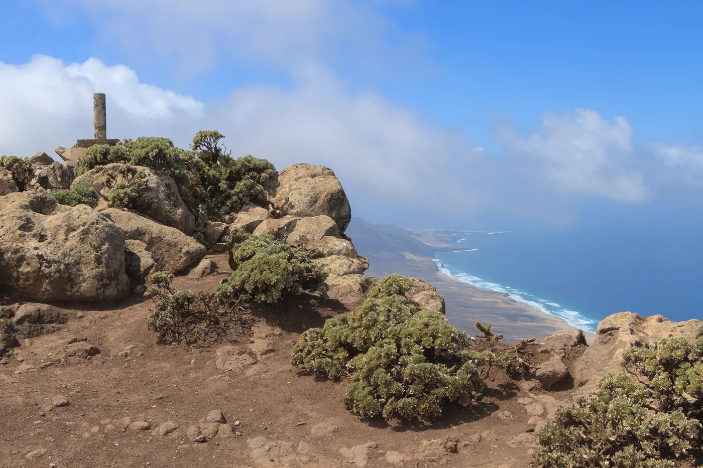
The rocky, wind-scoured summit of Pico de la Zarza, marked by an old post among boulders and low scrub, with a sweeping view down the Jandía coastline to a distant beach and the sea

Photo: H. Zell (CC BY-SA 3.0), via Wikimedia Commons

Jandía, Pájara, Fuerteventura

Pico de la Zarza

A demanding climb to the island's highest point, and its best view.

Pico de la Zarza is the summit of the Jandía massif and, at 807 metres, the highest point on Fuerteventura. The official PR-FV 54 route climbs to it from near Morro Jable, following a well-marked but exposed path with no shade for most of its length. It's a serious, full-day mountain hike rather than a casual walk — but the reward at the top is generally agreed to be the single best view on the island, taking in the Jandía peninsula's cliffs, the long curve of Cofete beach far below, and on a clear day the outline of other Canary Islands.

The hike: route, distance and difficulty

The official PR-FV 54 route covers around 8.7 kilometres one way from the trailhead near Morro Jable to the summit — most hikers walk it as an out-and-back, making the full round trip closer to 17 kilometres. Allow around 5 hours in total, more if you stop often; the ascent alone is commonly quoted at roughly two and a half hours for a fit walker moving at a steady pace.

The path is well waymarked (yellow-and-white PR markers) but genuinely demanding: a long, sustained climb over rough, rocky ground with real elevation gain and no technical sections requiring ropes or scrambling, but nothing to hide from the sun either. This is rated hard for a reason — it's the toughest maintained hiking route on the island, and not a trail to underestimate because the rest of Fuerteventura's terrain is gentle. Proper boots, several litres of water, sun protection and an early start all matter here.

The view from the top

What makes the climb worth it is the summit itself: a narrow, rocky ridge with a small marker post, looking straight down the length of the Jandía peninsula's dramatic west coast. Cofete beach — one of the island's longest and wildest — stretches out far below, backed by the same cliffs the trail climbs. On a clear day the view extends south toward Lanzarote and beyond; even on a hazy one, the sheer drop from the ridge to the coastline below is dramatic enough on its own.

This is also one of the few places on Fuerteventura where the island's volcanic, mountainous side is genuinely on display — most of the island's better-known landscape is flatter and more desert-like, which is part of why this particular summit has such a reputation among hikers who know the island beyond its beaches.

Where is Pico de la Zarza?

Frequently asked questions

See vacation rentals near Pico de la Zarza

Holiday homes and apartments within a short drive of Pico de la Zarza, closest first.